

Frenchmans Cap is an iconic white quartzite dome in the South West of Tasmania. I consider it one of the best single day mountain runs in the state. I’ve now run it three times and summited a total of five times. These big days out are core memories that I look back on fondly. Most walkers take 3–5 days to get to the summit and back. With fit legs and a good weather window it makes a long, very satisfying day out. It’s up there as one of my favourite Tassie day missions. In this guide I’ll cover everything you need to plan a one day run of Frenchmans Cap: the route, section distances, maps, logistics, weather, gear, nutrition and backup plans.

🏔️ Frenchmans Cap Basics
- Location: Franklin-Gordon Wild Rivers National Park, western Tasmania.
- Full Length: 47km (approx.)
- Elevation Gain: 2623 m
- Type: Out and back
- Booking Required: Not when running in a day, yes if planning on using the huts
- Permit Required: Tasmania Parks Pass (buy)
- Parks Pass Cost: A$12–$60 (chart here)
- Terminus: Frenchmans Cap Track carpark, Lyell Highway (start and finish) (about 3 hrs from Hobart)
- Highest Point: Frenchmans Cap summit, 1,446 m
- Difficulty: Challenging
- FKT: 5:47:10 (Angus Tolson, 2026) / 6:18:59 (Hanny Allston, 2017) (FKT)
🏃 How to run Frenchmans Cap?
Most people run it as a single day out and back from the Lyell Highway. Start early and turn around at the summit. The starting location is a long distance from anywhere, so you will either need a car or some form of transport to get there. And since it’s going to be a long day out you’ll either need to drive very early or find somewhere to stay nearby. I will discuss all of these options later in this post.

You can run it with your own crew of friends or if you want guidance along the way then Find Your Feet offer running tours from time to time. I would always recommend running it as a group unless you are incredibly experienced and know the track well. It’s much safer to move in a pack and a lot more fun to share the journey.
There are a few ways to go about running this epic trail, these are some of the options:
- Find a friend or a group of friends with similar fitness and commit to the challenge. I always recommend keeping groups to fewer than 4. The more people you have the more chance of something going wrong for someone.
- Find Your Feet Tours – they have in the past offered running tours of Frenchmans Cap. They don’t have any planned at the moment, but may organise one for you if you have enough keen people.
- Going it solo – I would only recommend this to someone who is highly experienced in Tasmanian alpine running and has already done the trail a few times before.
This post will focus on how to do it in a single push. This is the way I like to do it. It makes for a super epic day out. And if you start and finish in Hobart it is a surreal journey all the way to the top of an epic mountain and back home again in a single day. A journey that would take most people multiple days to undertake.
⚠️ Disclaimer: This is a highly remote and challenging route. You should only undertake this journey if you are physically fit enough, have adequate knowledge on how to survive in Tassie conditions when things turn bad and have a willingness to suffer a little. It’s not an easy feat doing this in one day!
Below is some footage from a mission Ziggy and I did a couple of years ago. A good insight into the terrain you have to contend with.
📋 Planning a Mission
🗺️ The Route
The track starts at the Lyell Highway carpark and drops almost immediately to a swing bridge over the Franklin River. From there it climbs steadily through rainforest over the shoulder of Mt Mullens (~600 m), then descends across buttongrass moorland on long sections of boardwalk. This part used to be known as the infamous “Sodden Loddons” mud field but has now been duckboarded thanks to donations from Dick Smith and lots of track work. You cross the Loddon River on a second swing bridge and continue on very runnable trails through to Lake Vera Hut.
From Lake Vera the track follows the lake shore through rainforest, then climbs steeply to Barron Pass (948 m). The trail becomes significantly rougher from here on in to the summit. The first proper views of the Cap open up at the top of the pass. The section across the exposed rocky plateau to Lake Tahune includes some ladders and vertical stairs, and it’s very exposed to wind in bad weather. From Lake Tahune Hut, a well cairned track climbs around 450 m via the North Col with some steep scrambling to the summit. Then you turn around and run it all back.
The descent from the summit can be sketchy in wet or snowy conditions. Then the traverse back to Barron Pass is much the same as the way out. Once you reach Vera Hut it will feel like you are on the home stretch, but there is still a way to go. The running gets easier but you will be on tired legs. The final climb back up Mt Mullens is disheartening and has been known to be the break point for many weary runners. Once this final hill is summited it is a cruisy descent back to the Franklin River and onwards to the carpark.


An example of the track conditions
📍 Section Overview
I have broken the trail into sections and provided brief descriptions for each section below.
| LOCATION | TOTAL (SECTION) DIST [km] | SECTION NOTES |
|---|---|---|
| Carpark | 0 (0.2) | Register before leaving. Drop down to the Franklin |
| Franklin River swing bridge | 0.2 (3.6) | Steady rainforest climb up Mt Mullens |
| Mt Mullens saddle (~600 m) | 3.8 (2.96) | Descend onto moorland and boardwalk |
| Loddon River swing bridge | 6.76 (8.74) | Fast boardwalk across Loddon Plains |
| Lake Vera Hut | 15.5 (3.2) | Toilet, rainwater tank. Last easy running before the climb |
| Barron Pass (948 m) | 18.7 (3.2) | Exposed rocky plateau, ladders and stairs |
| Lake Tahune Hut | 21.9 (1.6) | Toilet, rainwater tank. Steep 450 m climb to the summit |
| Frenchmans Cap summit (1,446 m) | 23.5 (1.6) | Turnaround. Don’t summit in poor weather |
| Lake Tahune Hut | 25.1 (6.4) | Refill water. Careful descending the wet quartzite, then back over Barron Pass |
| Lake Vera Hut | 31.5 (15.5) | Refill water. Fast boardwalk, then the climb over Mt Mullens and down to the Franklin |
| Carpark | 47.0 (0) | Sign out of the logbook |
🧭 Course Maps
I recommend downloading multiple maps to your phone for offline use. I use the following apps:
- Avenza Maps: I use the nswtopo map pack for the area
- Maps.me: Download offline maps as an alternative to Avenza maps
- Paper maps: Good to have if your phone dies. Parks recommends carrying the TASMAP 1:50,000 map
- Caltopo: see map embedded above, if you have a paid subscription you can download maps for offline use
- Strava segment: Segment Link
Related post: Mapping tools for Trail Runners
🕑 Time Estimates
Here are some estimates ranging from walking times through to the fastest:
- Parks walking times:
- Carpark → Lake Vera 5–7 hrs
- Lake Vera → Lake Tahune 4 hrs
- Lake Tahune → summit and back 2.5 hrs
- Total walking time ≈ 20–25 hours
- Realistic for a fit trail runner:
- < 9 hours (quite fit and experienced runner)
- 9 – 14 hours (moderate fitness)
- 14 – 18 hours (average fitness mid pack runner)
- Fastest known times: 5:47 (men’s), 6:19 (women’s)
Most of your time goes on the Lake Vera to the summit and back section. The boardwalk running out to Lake Vera is quick, but the climb to Barron Pass, the plateau and the summit scramble are slow going in both directions. Plan your turnaround time around the summit, not the distance.
If you are not good on technical terrain the final push will be the most challenging and time consuming. If the conditions are slippery the descent back from the summit can be treacherous. That is why it is always wise to turn back if the conditions are looking dicey. When in doubt definitely back out.
Here are some of the Strava activities from my various missions. I would consider myself probably on the higher end of fitness plus am decent at moving through the terrain.
| RUN | DATE | ELAPSED TIME | STRAVA |
|---|---|---|---|
| First | 4 Sep 2021 | 9:55 | View activity |
| Second | 23 Sep 2023 | 8:30 | View activity |
| Third | 2 Nov 2024 | 9:01 | View activity |
See my post about running Frenchmans Cap in a day back in 2023.
🎫 Permits
All you need is a valid Tasmania Parks Pass, plus you should register in the walker registration logbook at the trailhead before you start and sign out when you finish. No booking is required if you are going to be in and out in a day, and there are no track fees on top of the Parks Pass. If you hold an annual or holiday pass from the Overland Track or elsewhere in Tasmania, that covers you.
*If you are planning to stay a night in any of the huts, then you do need to book because spaces are limited and they try to manage numbers.
This post is current in 2026, be sure to verify current registration/booking requirements on the Parks Tasmania Frenchmans Cap page.
🚗 Logistics and Accommodation
The trailhead is on the Lyell Highway, 29 km west of Derwent Bridge. That’s roughly 3 hrs from Hobart or Launceston and about 1 hr from Queenstown. The carpark is free but small, so arrive early in peak season. There’s no reasonable public transport to the trailhead, so you’ll need a car.
I have done multiple trips driving up from Hobart early in the morning, doing the run then driving home after. This method can work if you are a faster runner and are up for the long drive home afterwards. If you want a more leisurely start and more time in the day I recommend staying nearby the night before and possibly the night after.
⛺ Accommodation
There are various places to stay in the vicinity of the trail head. Accommodation options for the night before:
- Lake King William: Free camping alongside the lake, Ziggy and I stayed here on a recent trip
- Derwent Bridge: closest, with a handful of options including the Derwent Bridge Wilderness Hotel
- Queenstown: more options, about an hour west, but a long way from anywhere
- Camping at Franklin River: you can hike in a few hundred metres and camp alongside the Franklin River. I’ve never done this but it looks like there is space for a few tents
My recommendation is to camp at Lake King William where it is free to camp and you are relatively close to the trailhead. Then pack up camp early in the morning and drive to the trailhead to start running. It’s a 28 minute drive from the campsite to the trailhead. If you need to rest before driving home you could head back and camp the following night there. Don’t risk driving 3 hours if you are in a sleep deprived, physically wrecked state.

🌦️ Weather
Weather is the biggest factor in whether Frenchmans Cap is a great day out or a dangerous one. It sits prominently on Tasmania’s west coast, one of the wettest parts of the state, and cops the full force of the westerlies. It can snow any time of year, and conditions can go from blue sky to sideways sleet in under an hour.
The first half of the run is fairly sheltered in rainforest and low moorland. The real exposure starts at Barron Pass. From there to the summit you’re on open rocky ground above 900 m, with nowhere to hide from the wind and rain. The summit quartzite gets very slippery when wet, and scrambling down it in poor conditions is where things are most likely to go wrong.
- Best time: Summer and autumn (Dec–Apr) offer the longest days and most settled weather. Spring can work with a good window but is often windy and unsettled. Avoid winter unless you’re very experienced in Tassie alpine conditions, because the days are short, there’s snow and ice on the tops, and the Lyell Highway can close.
- Pick your window: Look for a stable high-pressure system, ideally after a day or two of dry weather so the track has settled. Check the wind speed and freezing level at altitude, not just the valley forecast. Check the forecast the night before and again on the morning, and have a backup date if it’s marginal. I use the BOM Lake St Clair forecast and Mountain Forecast.
- Make the call at Lake Tahune Hut: This is your last good decision point. If the summit is wrapped in cloud, it’s raining or the wind is up, turn around. You’ll still have had a big day on one of Tassie’s best trails, and the summit will be there next time. When in doubt, back out.
- Hypothermia is the real risk: Wet and wind on the exposed section will chill you fast, especially if you slow down, stop or get injured. Carry your full waterproof and warm layers even if it’s sunny at the carpark, and put them on before you get cold, not after.
Be prepared to call off your mission entirely if the weather forecast is looking horrendous. It’s not even worth driving out there and the risks will be too high. Typically in the lead up to runs like this I will refresh the weather forecast a million times. Be sure to know your limits and make the call. There are no prizes for being a hero. You will suffer the wrath of the facebook bogans if you go out in bad weather and need to get rescued.
👯♂️ Choosing Your Party
It is important to choose your companions wisely on these long remote missions. You can be as fit and experienced as possible but you are only as strong as your weakest group member. Group sizes of 2- 4 are good to provide safety in numbers. But a larger group also increases the chance of something going wrong for someone.
You should only choose people that you feel confident have the ability, gear and experience to hold their own. Sometimes people’s enthusiasm gets ahead of their abilities. If the conditions are perfect then you can afford to have a longer day out but if things are looking dicey be sure to choose people that will be able to keep moving and get it done.
🎒 Gear List
Here is a basic gear list, this is essentially the bare minimum you should carry. The philosophy is to stay warm and comfortable while moving and to be able to survive if immobilised. This gear list should be adapted to the conditions and the time of year.
- Shoes: suitable trail runners with good grip in both mud and wet rock
- Running vest/pack (12–15 L)
- Waterproof jacket with taped seams and hood
- Waterproof pants
- Warm mid layer (fleece or synthetic puffy)
- Thermal top
- Thermal long johns
- Beanie and gloves (waterproof washing up gloves are good to have)
- Emergency bivvy or space blanket
- PLB or satellite messenger
- Headtorch and spare batteries
- First aid kit and snake bandage (important!!), carry some medications too such as paracetamol and anti-histamines
- Phone with offline maps and a battery bank
- Paper map (TASMAP 1:50,000) and compass
- Water bottles/soft flasks (1–1.5 L capacity)
- Food for the full day plus an emergency reserve
Check out my Overland Track Guide for an extensive winter gear list! That gear list got us safely through a day of torrential rain in the middle of winter.
Related post: Guide to Trail Running the Overland Track
📶 Communications and Backup Plans
There’s little to no mobile reception along most of the track, so don’t count on your phone for comms. Carry a PLB at minimum, and ideally a satellite messenger (e.g. Garmin inReach) so you can send check-ins.
- Register in the logbook before you start and sign out when you finish
- Leave your route, planned turnaround time and latest expected return with someone at home
- Bail-out options: It’s out and back, so the only real bail-out is turning around. Lake Vera and Lake Tahune Huts are good places to shelter if the weather turns or you’re running late
- Set a hard turnaround time for the summit and stick to it
- There are no permanent rangers on track, though there may be a summer ranger at one of the huts
Note on mobile reception: you will get glimpses of phone reception at various points along the trail, these are the known locations I can remember:
- Barron Pass high point
- Frenchmans Cap summit
If you do not have a satellite comms device, these are good locations to send check ins to people back at home to let them know you are safe and how you are travelling. Also good locations to call for help if needed without having to resort to using the PLB. Using a PLB sends out an emergency message without any context. A message from a phone or sat device with information about your plight will lead to a quicker more relevant emergency response.
🍽️ Nutrition and Hydration Planning
Plan for the full day out based on time, not distance. The second half is much slower than the boardwalk suggests. Water is easy to come by with the hut tanks at Lake Vera and Lake Tahune, so you can carry less water and more food. On a normal temperature day you should be able to get by with 1000ml capacity, but adjust this up on hot days.
Carry a combination of solid food and energy gels and such. Budget for at least 200kcal per hour. Always err on the side of carrying more. Ensure you have a good mix of salty, savoury and sweet. I find that the longer the run the more I crave real food rather than sports products.
Check out my nutrition planning spreadsheet if you want to crunch the numbers and see if you’re carrying enough to see you through.
Related post: Nutrition Scorecard Spreadsheet
Note on Drinking Water
Both Lake Vera and Lake Tahune Huts have rainwater tanks, which are the most reliable refill points. You’ll get one refill each way at each hut. There are also plenty of creeks and the Loddon River along the way. Tassie water is generally good, but with hut toilets and heavy walker traffic I’d treat anything from creeks or lakes, especially near the huts.
There is usually some water running off a cliff on the way up Barron Pass, this is fairly reliable and drinkable even on hot days. Plus there is a little creek that you cross on the way towards Barron Pass. Be sure to load up on water at each of the huts because there can be long stretches between available refills.
🏁 Summing Up
Frenchmans Cap in a day is one of the best mountain runs in Tasmania. It starts with fast boardwalk through the button grass, then rough, rocky alpine terrain, then a scramble to the top of a quartzite dome with views across the wild west. It’s a long, tough day though, and the mountain doesn’t care how fit you are. Pick a good weather window, start early, carry the full kit and stick to your turnaround time.
If conditions turn, back out. It isn’t going anywhere, and walking away to come back another day is always the right call. Get it right and you’ll finish with a compulsory dip in the Franklin River, sitting in the cold water with tired legs and looking back at what you’ve just done.
If you’re after more Tassie missions, check out my Overland Track guide and my write up of running Frenchmans Cap in a day.
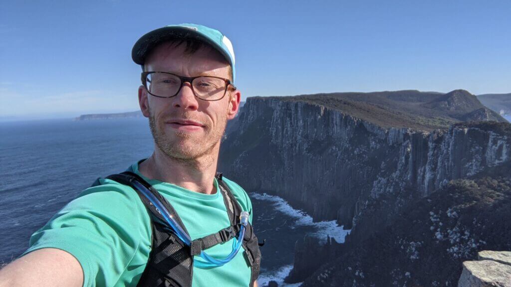
Joseph Nunn: An avid trail runner based in Hobart, Tasmania. He loves getting out for big days on the trails with mates or racing against them.
Want to read more content like this? Subscribe to my blog and get new posts delivered straight to your inbox every 2 weeks.